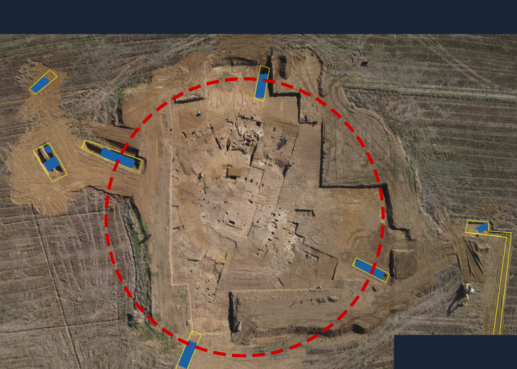
During the 2018 excavation campaign at Vetricella, seven exploratory trenches were opened to investigate the nature of the ditches surrounding the site.
Thanks to the preliminary results obtained from the trenches excavated during the 2016, we tried to deepen the role of the intermediate ditch (the most deepest and largest), with the opening of four trenches (Fig.1) excavated at the cardinal points (North, South, East, West).
To increase the knowledge of the backfill of the ditch and to make a preliminary correlation between the phases of its use and the phases of occupation of the archaeological site, the backfills were removed by stratigraphic levels, accompanied by graphic and photographic documentation and by the collection of the finds here included.
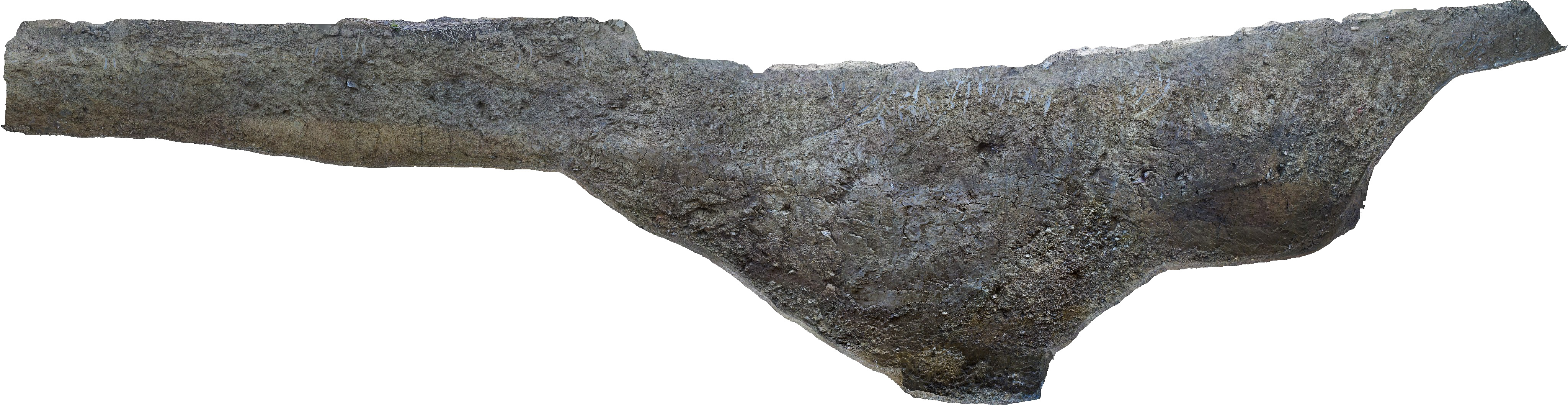
The exposed sections (Fig.2) have been documented through a three-dimensional survey carried out with digital photogrammetry and the obtained stratigraphies have been described in accordance with the geoarcheological method of sedimentary facies.
The sections were also sampled both for future paleo-environmental analysis (pollen, foraminifera and ostracods, charcoals), and geoarcheological analysis (weaving, mineralogy, micro-morphology), as well as for chemical and phosphate analysis.
The preliminary analysis carried out in excavation time revealed, in the four open trenches, a complex and diversified depositional situation, highlighting a well planned and high-level engineered work.