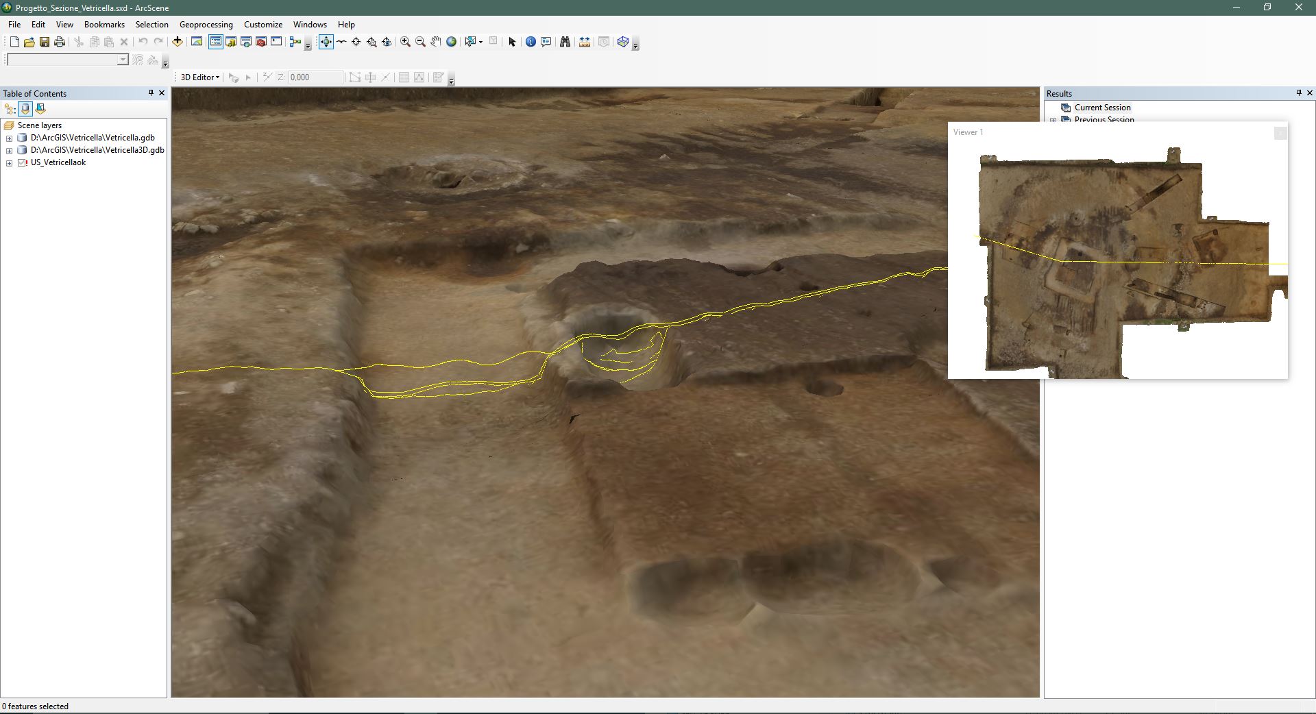
The 3D documentation carried out at the Vetricella site (Scarlino,GR) has reached its final stage.
All the models are elaborated and georeferenced, and then imported into a GIS with a 3D visualization platform. This system allows the researchers to join the spatial data and alphanumeric contents, recorded on field in a context sheet and then stored in a database.
Moreover it is possible to navigate and expore the 3D models through queries applied to the attributes of the objects.
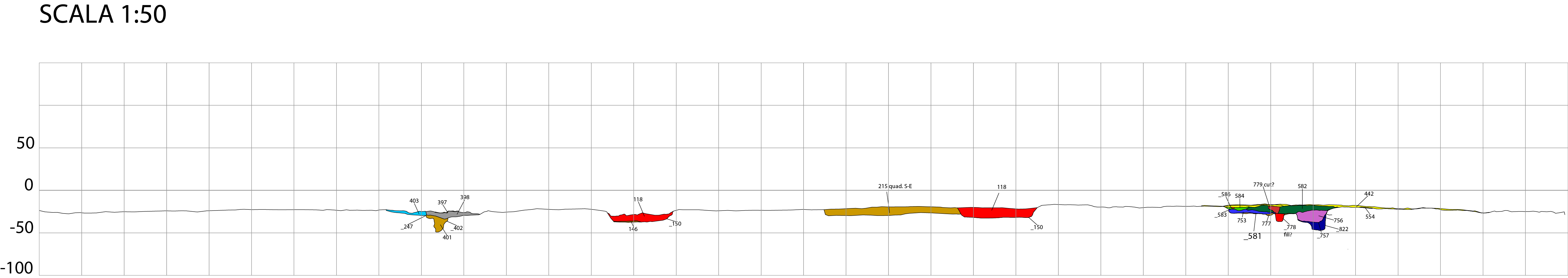
The most useful products that can be implemented automatically and immediately with this data structure are (Fig.2-3):
- the phase plants
- the sections created with 3D interpolation tools