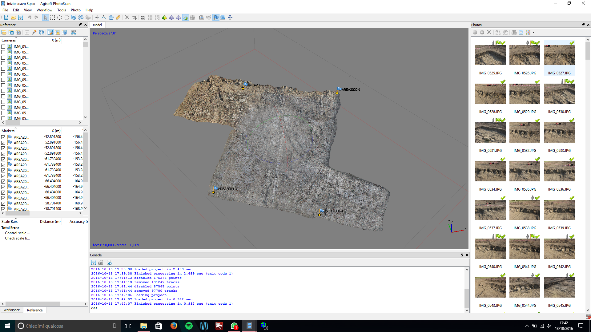
At the excavations of Vetricella (Scarlino) and Carlappiano (Piombino) an Image-based 3D modelling technique is used for the documentation of the entire stratigraphy. We decided to use the 3D model as the main form of documentation for its high precision in recording the geometry and the colours of the contexts. 3D models obtained during the excavation are gathered into a 3D GIS platform, where the stratigraphy is reconstructed, managed and analysed in three dimensions (Fig.1).
For each context the following procedure is provided:
- Photographic acquisition: several pictures of the context are taken according to specific rules
- 3D models elaboration: the pictures are processed directly on the field with a specific Image-based 3D modeling software on a laptop. At the end of the processing we get the high resolution 3D model of the context provided with colour information stored as a texture file.
- Georeferentiation: 4 markers are measured with the total station and the relative coordinates are assigned to the markers visible on the 3D model. Using additional control points, the contour lines of the contexts are highlighted and cut directly on the surface of the 3D model.
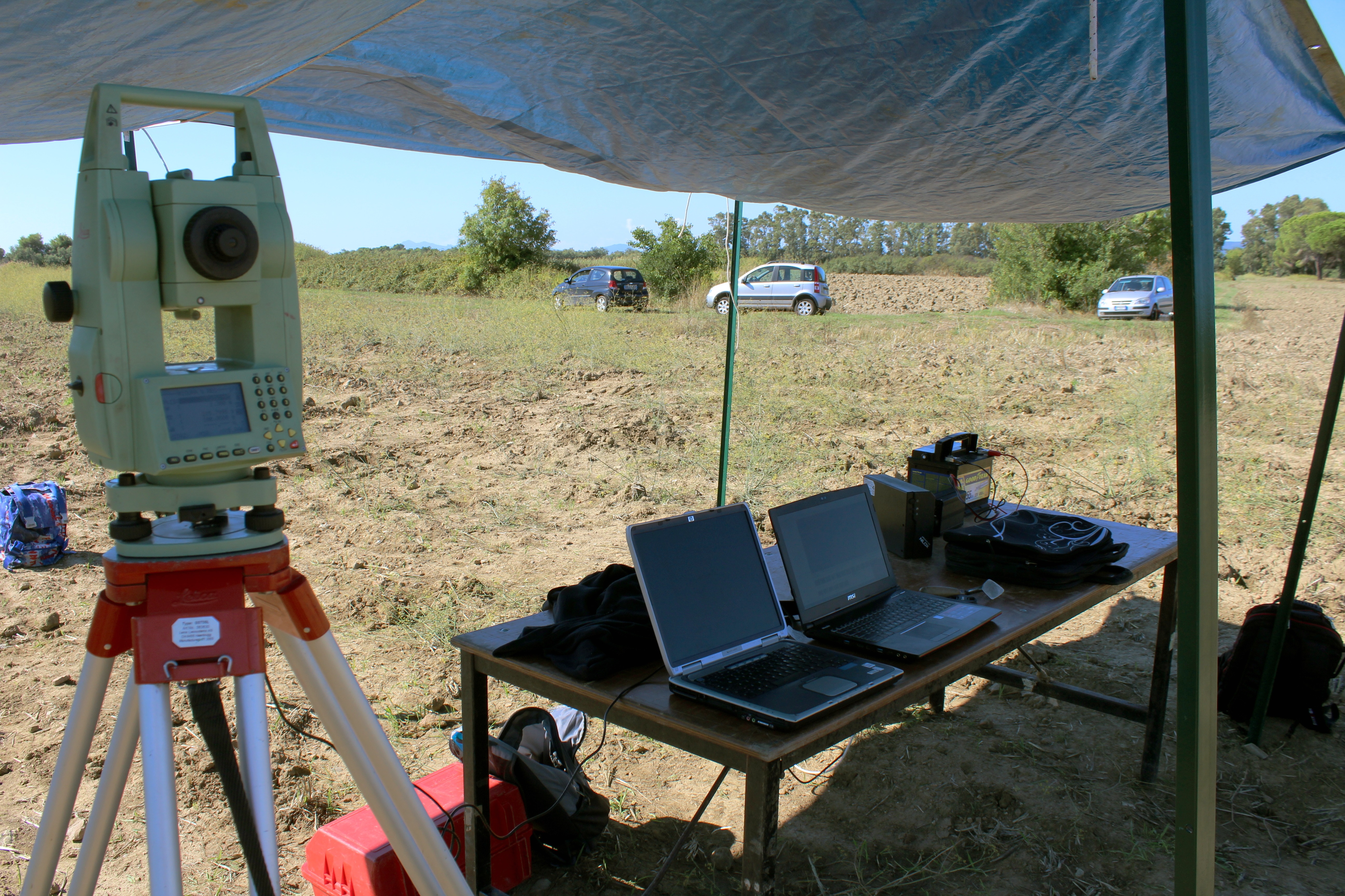
The systematic documentation of each contexts of the excavations is allowed by the use of an electric power supply. Specifically, a car battery is connected to an inverter, providing 300W for six hours of electricity.