3D documentation procedure atthe excavations of Vetricella and Carlappiano, in the frame of the nEU-Med project.
- Highlight the context’s boundary.
-
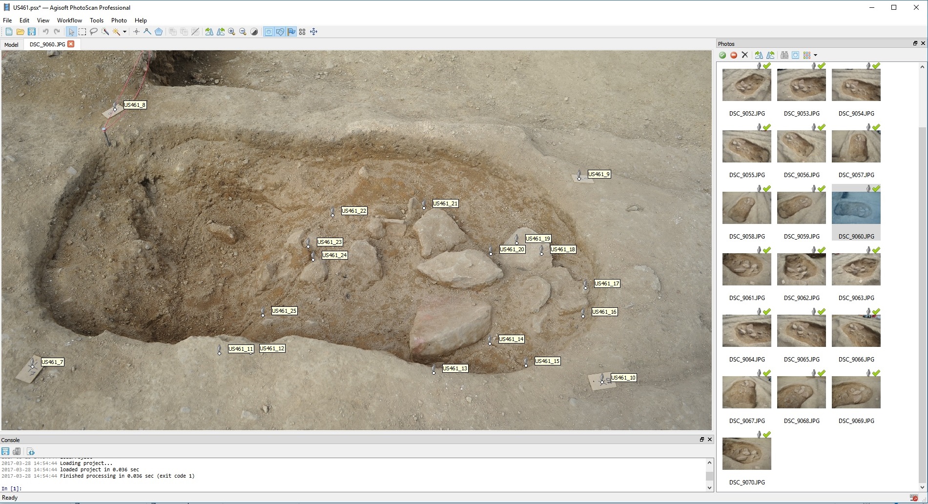
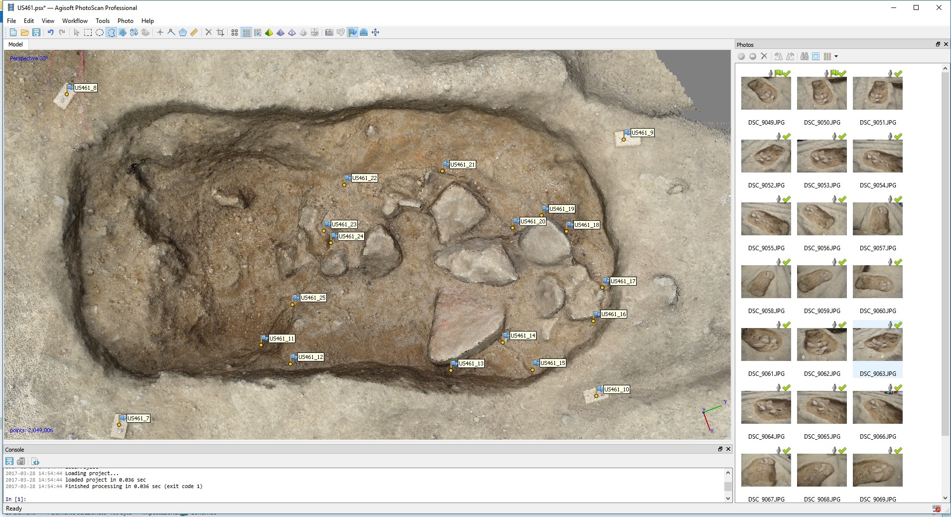
Placement of four markers around the context for the georeferentiation of the 3D model. Besides the four markers, with the total station several additional points are measured along the boundary. These points create a path for detecting the context’s boundary directly onto the 3D model. This step is fundamental for keeping a reliable detection of the boundaries inside the virtual environment, because only on the field it is possible to accurately divide the archaeological deposit into contexts, relying on the parameters of consistence, composition, and colour. (Fig.1)
-
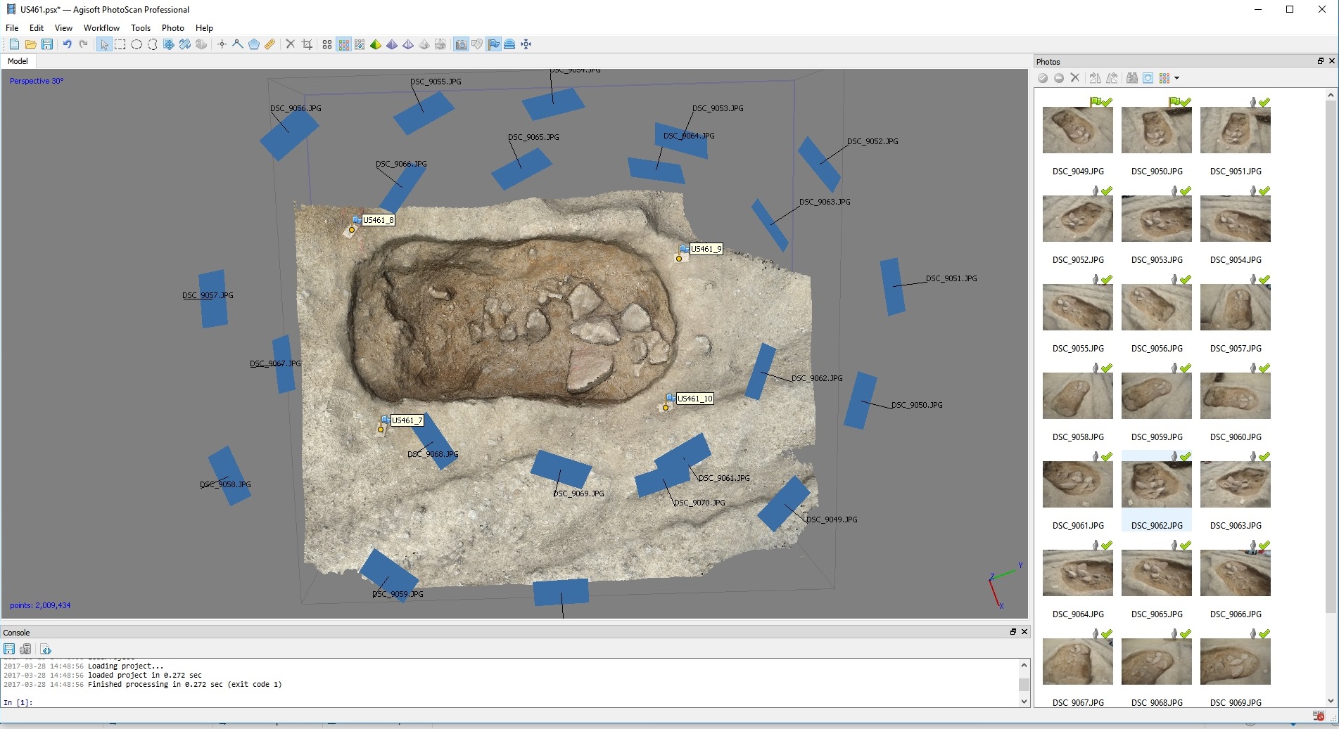
Photographic acquisition of the context for the 3D modeling elaborationusing the software Agisoft Photoscan. Photoscan combines the photogrammetric principles with the algorithms of Structure From Motion and Dense Stereo Matching, elaborating 3D models in a semi-automatic way from a set of photographs, taken following specific rules. One of the fundamental rule is that each point of the scene (including the markers) must appear in at least two photographs, taken from different angles.
- Transfer of the photographs to the computer and elaboration of the 3D models in Agisoft Photoscan.
-
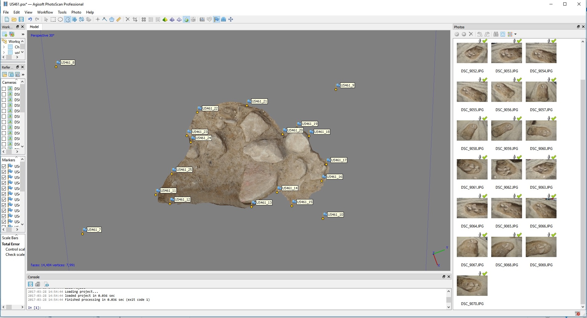
Transfer of the measured points from the total station to the computer and identification of the position of the four markers on the 3D model. Once this step is completed, all the points measured on the context’s boundary will be automatically projected onto the model, enabling the definition and the cut of the exact extension of the context. (Fig. 3-4)
-
The 3D georeferenced model is exported with a texture file that stores the colour information. The creation of a 3Dmodels’ dataset of the entire excavation enables the reconstruction of the entire stratigraphy in 3D inside a visualization platform.